


Sub-meter accuracy
Typical positioning accuracy of 0.3–0.5 m — about ten times more precise than Bluetooth positioning based on signal strength.

Indoor Positioning
Bluetooth AoA real-time location system for people and assets, with 0.3 m accuracy
Typical positioning accuracy of 0.3–0.5 m — about ten times more precise than Bluetooth positioning based on signal strength.
A single anchor covers a diameter of up to 45 m and tracks up to 500 tags at once, with sub-second location updates.
Works with any BLE 4.0+ device — badges, wristbands, asset tags, watches and smartphones — at a significantly lower cost than UWB.
The positioning engine runs on your own infrastructure and delivers coordinates to your systems through an open API.
Technology
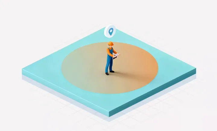
1st generation
Confirms only that a tag is inside a zone, without a continuous position.

2nd generation
Estimates the distance from signal strength: 5–10 m accuracy and unstable location data.

3rd generation · Crypto Locate
0.1–1 m accuracy and a continuous track of every person and asset.
Working principle
Each anchor has an array of antennas that measures the angle at which the Bluetooth signal of a tag arrives. The positioning engine turns these angles into coordinates on the map of the site.

The anchor measures the pitch and heading angle of the signal. With the known height difference between the anchor and the tag, the engine calculates the X and Y position.

Angles measured by several anchors intersect in space. The engine triangulates them into full X, Y and Z coordinates.
| Specification | Bluetooth AoA | Bluetooth RSSI | RFID |
|---|---|---|---|
| Designed for positioning | Yes | No | No |
| Typical accuracy | 0.3–0.5 m | 5–10 m | Zone level |
| Refresh rate | High | Low | Medium |
| Compatible devices | Phones, wristbands, watches, badges, IoT tags | Tags need an extra data return function | Proprietary tags only |
| Tag power consumption | Low | Low | Medium (active) |
| Anchor cost | Medium | Low | Medium (active) |
| Tag cost | Low | Low | Medium (active) |
| Works as an IoT gateway | Yes | No | No |
| Deployment complexity | Medium | Medium | Low |
System
The system is modular: you can deploy the complete solution, or add individual components to the infrastructure you already have.

01
Mounted on the ceiling or wall, anchors with an antenna array measure the angle at which the signal of each tag arrives and compute the phase difference in real time.

02
Badges, wristbands and asset tags worn by people or fixed to equipment send a Bluetooth signal. Depending on the model, the battery lasts up to 5 years.

03
The engine turns the angles into coordinates, and the platform shows them on the map, raises alarms and passes the data to other systems through the open API.

Anchors
Both anchors track up to 500 tags at the same time and can be combined in one installation — the standard anchor indoors, the enhanced one in large halls and outdoors.

Slim and light anchor for offices, hospitals and retail.
| Accuracy | 0.3 m |
|---|---|
| Coverage diameter | ≥ 25 m |
| Protection | IP65 |
| Compatibility | BLE 4.0 and above |
| Dimensions | 220 × 220 × 32 mm |
| Weight | 680 g |
| Max. installation height | 10 m (ceiling or wall) |
| Power supply | PoE IEEE 802.3af, 48 V |
| Rated power | 3 W |
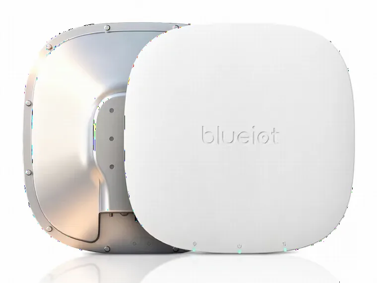
Industrial anchor for large halls and for tracking assets outdoors.
| Accuracy | 0.3 m |
|---|---|
| Coverage diameter | ≥ 45 m |
| Protection | IP68 |
| Compatibility | BLE 4.0 and above |
| Dimensions | 330 × 330 × 53 mm |
| Weight | 680 g |
| Max. installation height | 10 m (ceiling or wall) |
| Power supply | PoE IEEE 802.3af, 48 V |
| Rated power | 3 W |
Tags
Every tag is located with the same accuracy of 0.3 m — they differ in shape, battery life and protection. Any other device with Bluetooth 4.0 or newer can also be used as a tag.
Platform

Live position and track of every person and asset on the map, with quick search and follow mode for a selected target.

Floor plans are imported in TIFF, DXF, PNG, FBX or SHP format, with switching between 2D and 3D view.

Draw custom zones and get alarms on entry and exit, with allow and block rules for every zone.

Organization tree, issuing and returning tags, battery monitoring with low battery alerts and role-based access.

Accelerated playback of several tags at once, the full route with one click and a history of up to one year.
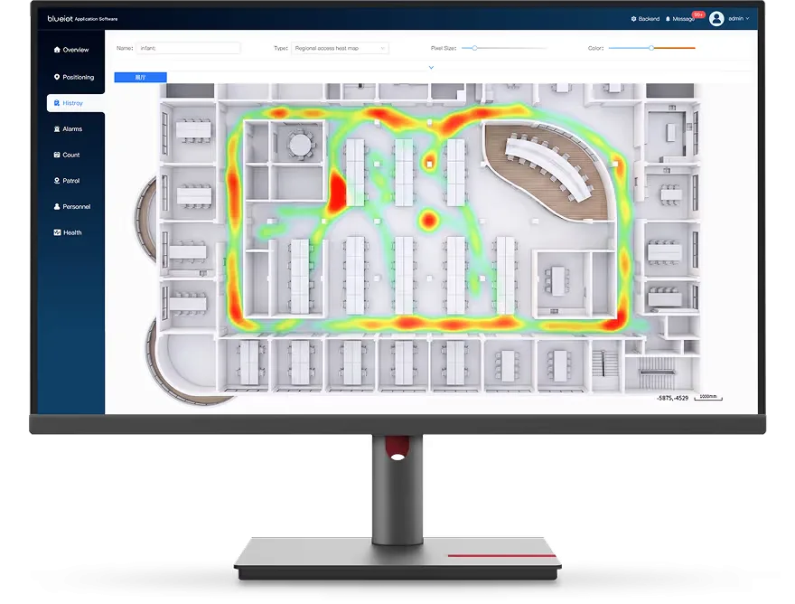
Heatmaps for any area and time period, viewed by person or by zone.

The platform switches camera feeds automatically and synchronises the video with the position of the tracked target.
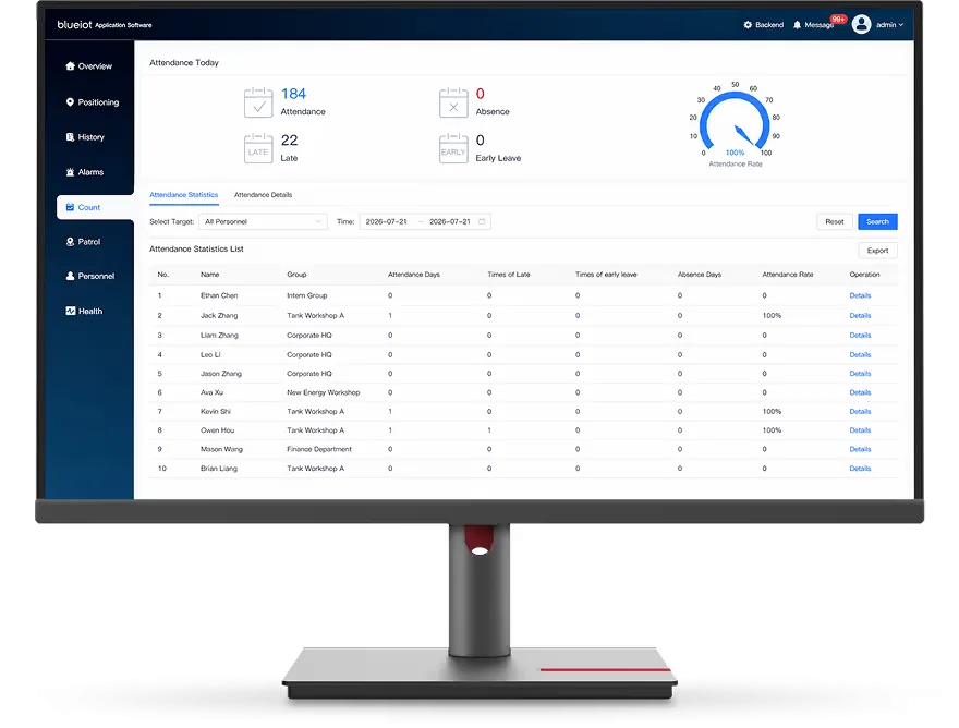
Attendance records based on location, with multiple shifts, shifts across midnight and an audit trail.

High-precision location and indoor navigation on a smartphone, with routing across several floors and maps of the site.
Location data is delivered to your systems through WebSocket, JavaScript and HTTP interfaces.
Applications
Tracking of production lines, forklifts and pallets, and support for warehouse automation.
Real-time visibility of goods and inventory, and faster picking.
Tracking of staff, patients and medical equipment, for greater patient safety.
Monitoring of restricted zones with geofencing alarms and an SOS button on the badge.
Positioning of people and assets, and data on how the space is really used.
Visitor flow analytics, exhibit positioning and interactive navigation.
Passenger flow and tracking of terminal equipment.
Vehicle tracking and guidance to a free parking space.
FAQ
Performance figures are theoretical values measured in a specific test environment; results in a real installation may differ.
Typical accuracy is 0.3–0.5 m indoors, about ten times more precise than positioning based on signal strength (RSSI).
One anchor tracks up to 500 tags at the same time with sub-second updates, and a complete installation supports more than 100 000 tags.
From a few months to more than five years, depending on the tag model and how often it reports its position.
Bluetooth AoA reaches sub-meter accuracy on standard BLE hardware, so tags and infrastructure cost significantly less than with UWB, and existing Bluetooth devices and smartphones can be used as tags.
Yes. The positioning engine delivers coordinates through an open API (WebSocket, JavaScript and HTTP), so location data can be used in your own applications and platforms.
With a demo kit: anchors, tags and preloaded software that let you check the accuracy in your own space before you plan the full installation.
Demo kit
The demo kit contains anchors, tags and preloaded software, so you can check the accuracy on your own site before planning the full installation.